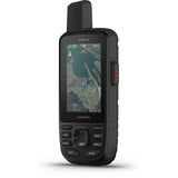
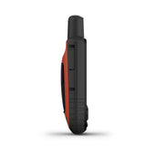
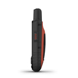
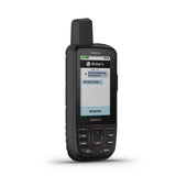
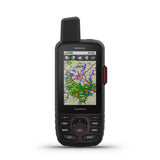
The Garmin GPSMAP 66i, a first-of-its-kind backcountry tool that bundles high-detail mapping and navigation with two-way satellite communication in a single handheld device.
With the GPSMAP 66i, you can send and receive messages through the Iridium® satellite network; trigger an interactive SOS; track and share your location; navigate with highly detailed, preloaded TOPO maps; and download BirdsEye Satellite Imagery directly to the device. You can also create new tracks, drop waypoints, receive updated weather forecasts, and calculate road and trail mileages. Whether you’re a professional guide or you frequently travel out of cell phone range (hiking, skiing, mountain biking, geocaching or kayaking), the GPSMAP 66i offers greater peace of mind for anyone adventuring outdoors.
The GPSMAP 66i combines high-detail GPS mapping and inReach satellite messaging capabilities, allowing you to communicate with loved ones as you navigate the backcountry.
- Weight: 8.5 ounces
- Dimensions: 6.4 x 2.6 x 1.4 inches
- Display: 3-inch, sunlight-readable color display
inReach technology offers two-way satellite communication with global coverage.
The GPSMAP 66i operates on the Iridium satellite network for the best coverage available. It allows you to send and receive text messages and emails around the world—in theory, it’d even work if you were sailing in the middle of the Pacific Ocean or trekking to the top of Mount Everest. (Note: Some locations regulate or prohibit the use of satellite communication devices. Know and follow all applicable laws in the place where you’re traveling.)
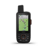
Like other Garmin inReach devices, the GPSMAP 66i can talk to cell phones, email addresses and other inReach devices. It uses a similar keyboard to the one found on the Garmin inReach Explorer+ satellite messenger, with auto-suggest and auto-complete word options that make communicating easier and faster. (This is an improvement over models like the GPSMAP 64, GPSMAP 66s and GPSMAP 66st, which don’t use shortcuts for entering long text strings.) The GPSMAP 66i also allows for customizable, preset texts, and can also automatically ping or send preloaded messages at preset intervals—so you can let family and friends know you’re okay. Here, you can see what it looks like to receive an incoming message while accessing a topographic map:
Much like texting, communication happens in near-real time. If you’re back-and-forth messaging, texts will come in immediately. If you go idle, the device will back off and stop checking for responses to save power (if operating in default mode, it will check for new messages every 10 minutes). The GPSMAP 66i is also Bluetooth-enabled, so you can pair it with your smartphone and use the Garmin Explore app to read and compose messages. (The app also lets you pair your inReach with your mobile device’s contact list to make communication even easier.)
High-detail tracking lets loved ones know where you are.
The GPSMAP 66i has live location tracking, so every 10 minutes your location is sent to the MapShare tracking page, where friends and family can follow your adventures, ping you, and send messages in near real time. (You can embed your MapShare page on your social media accounts or website.) Like most features on the GPSMAP 66i, you can customize the tracking settings to suit your needs, so if you’d like longer intervals to conserve battery life, you can use Expedition mode and and choose a LiveTrack interval that’s appropriate for your activity, for example.
Trigger an interactive SOS with the push of a button.
In the event of a life-threatening emergency, the Garmin GPSMAP 66i allows you to use the Iridium satellite network to trigger an SOS to GEOS, a 24-7 emergency monitoring-and-response center. Someone will respond to your message, track your device and dispatch local search and rescue to your exact location. You’ll be able to text with emergency-response personnel and receive confirmation that help is on the way with real-time updates while you wait. (Once you’ve deployed an SOS, the device cannot be turned off unless the SOS is canceled, but the GPSMAP 66i will activate power-saving controls in order to maintain battery life for as long as possible.)
Get the most out of top-notch mapping and navigation.
High-resolution color satellite imagery makes finding trailheads and campsites easier.
The GPSMAP 66i comes preloaded with TOPO maps of the U.S. and Canada, which are similar in resolution to the maps on the inReach Explorer+ (other inReach devices don’t come with any). With a microSD card, you can load the device with additional maps for flexibility. (The GPSMAP 66i comes with 16GB of built-in memory.) You can also download high-resolution BirdsEye aerial imagery directly to the device using the built-in Wi-Fi, with no subscription required (the earlier GPSMAP 64 came with a free 1-year subscription for this feature).
The GPSMAP 66i lets you calculate precise road and trail routes, as well as leave a breadcrumb trail (which would allow you to safely navigate back the way you came). Use the Garmin Explore website and app as a companion to help you manage waypoints, routes and activities, review trip data from the field, and sync info across devices.
Save battery by adjusting performance.
The Garmin GPSMAP 66i uses a rechargeable internal lithium-ion battery and comes with a standard micro-USB charging cable. In the default setting, battery life tops out at 35 hours with 10-minute tracking, but you can extend battery life to up to 200 hours with 30-minute tracking by switching to Expedition mode. In this mode, Bluetooth is disabled and the level of map detail is reduced (from 1-second tracking to 1-minute tracking in default mode). Users of the Garmin inReach Explorer+ will notice that the battery life of the GPSMAP 66i is significantly shorter than the inReach series, but that’s due largely to the detailed tracks and more frequent location-sharing intervals.
When the battery is low, there are several points when the device notifies you with warnings and active steps to help maximize the length of time the device can remain powered on.
Other cool features and navigation aids:
- Equipped with ANT+ wireless technology, the device pairs with Garmin-compatible devices (like the Garmin Fenix 5 series watches or the Forerunner 935 GPS watch), from which you can send and receive inReach messages, or even trigger an SOS.
- Maps for temperature, precipitation (see image above), wind and clouds; basic, premium and premium marine satellite weather forecasts provided via inReach capabilities (rates depend on your subscription plan)
- Sun and moon feature for sunrise, sunset, moonrise and moonset information based on your positioning
- Built-in navigation sensors like an electronic compass, a barometric altimeter and an accelerometer
- Multiple Global Navigation Satellite Systems (GNSS) support and navigation sensors
- LED flashlight and SOS beacon
- Photo-viewing ability via a microSD card
- 250,000 preloaded geocaches (and the ability to download even more)
- Ability to post updates to social media through the Explore website and app
- Shock- and impact-resistant
- Water-resistant up to 1 meter for up to 30 minutes
Size and Weight
Users of Garmin’s GPSMAP 66s, GPSMAP 66st, and inReach Explorer+ won’t notice a significant difference when comparing the weight and dimensions of the GPSMAP 66i, which is roughly the same size at 6.4 x 2.6 x 1.4 inches, and just a hair heavier at 8.5 ounces (compared to the 8.1 ounces of the 66s and 66st and 7.5 ounces for the Explorer+). For all its functionality, the GPSMAP 66i, isn’t cumbersome to hold, and the interface is straightforward to operate. The GPSMAP 66i stows easily inside a backpack, and since it’s weather resistant, you can hang it from your pack or body, allowing quick access it without getting in the way.
At 6.4 inches tall, the Garmin GPSMAP 66i is comparable in size with most smartphones.
Accessing the Iridium satellite network requires a data plan.
In order to take full advantage of the device’s inReach capabilities—in particular, two-way messaging, interactive SOS, live tracking and location sharing, as well as satellite weather updates—an active satellite subscription is required. Garmin offers a number of options to suit most users. Choose between the monthly Freedom Plan, which allows you to press pause on your subscription in between adventures, or the Annual Plan, best suited to those who require year-round satellite access.
Specs:
General |
|
| PHYSICAL DIMENSIONS | 6.6 x 16.3 x 3.5 cm |
|---|---|
| DISPLAY SIZE | 3.8 x 6.3 cm; 3" diag (7.6 cm) |
| DISPLAY RESOLUTION | 240 x 400 pixels |
| DISPLAY TYPE | Transflective colour TFT |
| WEIGHT | 241 g |
| BATTERY | rechargeable lithium-ion |
| BATTERY LIFE | Up to 35 hours at 10-minute tracking; up to 200 hours at 30-minute tracking (power save mode) |
| WATER RATING | IPX7 |
| MIL-STD-810 | yes (thermal, shock, water) |
| HIGH-SENSITIVITY RECEIVER | |
| INTERFACE | high speed micro USB and NMEA 0183 compatible |
| MEMORY/HISTORY | 16GB |


